경로 이동을 간단하게
아웃도어, 자전거, 러닝, 여행, 지도, GPS 경로를 Google Earth, 운동 앱, 계획 도구, GPS 장치 사이에서 옮깁니다.
지도 파일 변환기 solves common route-file friction before a trip, race, ride, or GIS handoff.
아웃도어, 자전거, 러닝, 여행, 지도, GPS 경로를 Google Earth, 운동 앱, 계획 도구, GPS 장치 사이에서 옮깁니다.
경로 파일은 변환 중에도 기기에 남아 있습니다.
KML 색상, 아이콘, 레이어 스타일이 GPX로 완전히 변환되지 않으면 알려줍니다.
지도 파일 변환기 focuses on route-file structure, not single coordinate formatting.
지도 파일 변환기 turns GPX tracks, routes, waypoints, elevation, timestamps, and names into a KML file for Earth viewers.
지도 파일 변환기 extracts KML LineString, gx:Track, and Point data into GPX tracks and waypoints, with style warnings when needed.
지도 파일 변환기 exports tracks and routes as GeoJSON LineString features and waypoints as Point features.
지도 파일 변환기 converts KML paths and points into a clean FeatureCollection for web maps and GIS workflows.
지도 파일 변환기 reports route names, point counts, elevation fields, timestamps, track points, route points, and waypoints.
지도 파일 변환기 creates a target GPX, KML, or GeoJSON file directly in your browser after conversion.
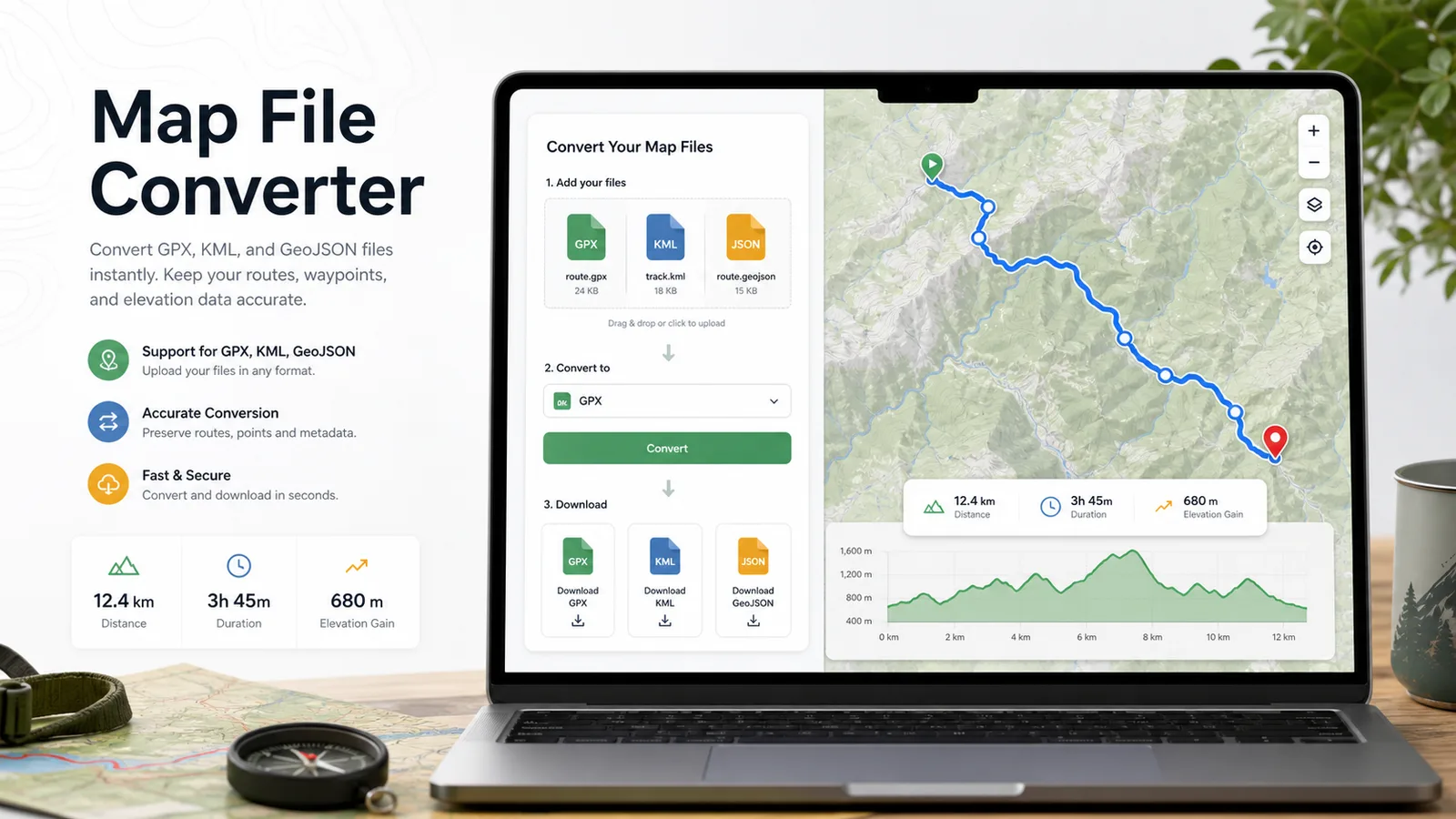
지도 파일 변환기 needs only three steps: upload, review, convert.
Choose a GPX, KML, GeoJSON, or JSON file. 지도 파일 변환기 checks file size and structure before parsing.
지도 파일 변환기 shows route name, source format, target format, tracks, routes, waypoints, point totals, elevation values, and timestamps.
Select GPX, KML, or GeoJSON as the target, run conversion, then download the generated file for your map app, sports app, planner, or GPS device.
지도 파일 변환기 keeps upload, route analysis, warnings, and file download on the same page.
Drop in GPX, KML, or GeoJSON and choose GPX to KML, KML to GPX, GPX to GeoJSON, KML to GeoJSON, or GeoJSON export paths.
Before download, 지도 파일 변환기 summarizes track points, route points, waypoints, elevation, timestamps, route name, and possible field loss.
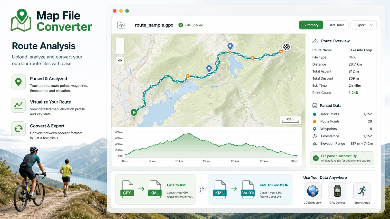
지도 파일 변환기 is built for people moving real route files between different mapping ecosystems.
Use 지도 파일 변환기 to move hiking, road-trip, and travel routes between Google Earth, route planners, and mobile navigation apps.
Use 지도 파일 변환기 to prepare GPX or GeoJSON route data for sports dashboards, ride planners, and race-day files.
Use 지도 파일 변환기 to cleanly export route and waypoint data for GPS devices that prefer GPX.
Common questions about 지도 파일 변환기.
지도 파일 변환기 converts GPX, KML, and GeoJSON route files. Priority paths are GPX to KML, KML to GPX, GPX to GeoJSON, and KML to GeoJSON, with GeoJSON export paths also available.
No. 지도 파일 변환기 parses and converts the file in your browser tab, so route data is not sent to a server during conversion.
KML can contain colors, icons, folders, and layer styles. GPX is mainly for tracks, routes, and waypoints, so 지도 파일 변환기 warns that style information may not fully survive KML to GPX conversion.
LatLong Coordinate Converter handles single points and coordinate formats. 지도 파일 변환기 handles complete route files with many points, names, elevation values, timestamps, tracks, routes, and waypoints.